
Maps play a vital role in defining national borders. Before independence, India included Pakistan and Bangladesh (then East Pakistan). Post-independence, these regions became three separate nations.
In recognition of India’s 78th year of independence, maps by prominent cartographers like Seutter, Rennell, Mortier, Lapie, Bonne, and Tallis will be exhibited. Each map tells a unique story, highlighting the shifting boundaries over the centuries. These maps, printed in England, France, Italy, and the USA, provide insight into the subcontinent’s historical geography. Every map recounts a story that traces back through history.
“The exhibition features cartographic works spanning 350 years. The display is not chronological, so two adjacent works might be separated by two or even three centuries,” stated Anubhav Nath, Director, Ojas Art.
Cartography, the art of depicting geographical areas, peaked in the 17th-19th centuries as explorers charted new territories and accurately marked locations using longitudes and latitudes. This period saw extensive commissioning of maps by Western powers. Cartography also serves an educational purpose, helping to understand changing geographical boundaries and their causes. The displayed collection emphasizes maps of Pre-Independence India, encompassing present-day India, Pakistan, and Bangladesh.
“India’s geography has been shaped over centuries and these maps narrate stories that transcend beyond their intricate demarcations. Each of these rare maps helps people relate to an era or period through their intricate geographical enunciations and altering boundaries that they represent. One tends to discover something new in the same map on a daily basis!” adds Anubhav Nath.
Approximately 100 maps will be on display.
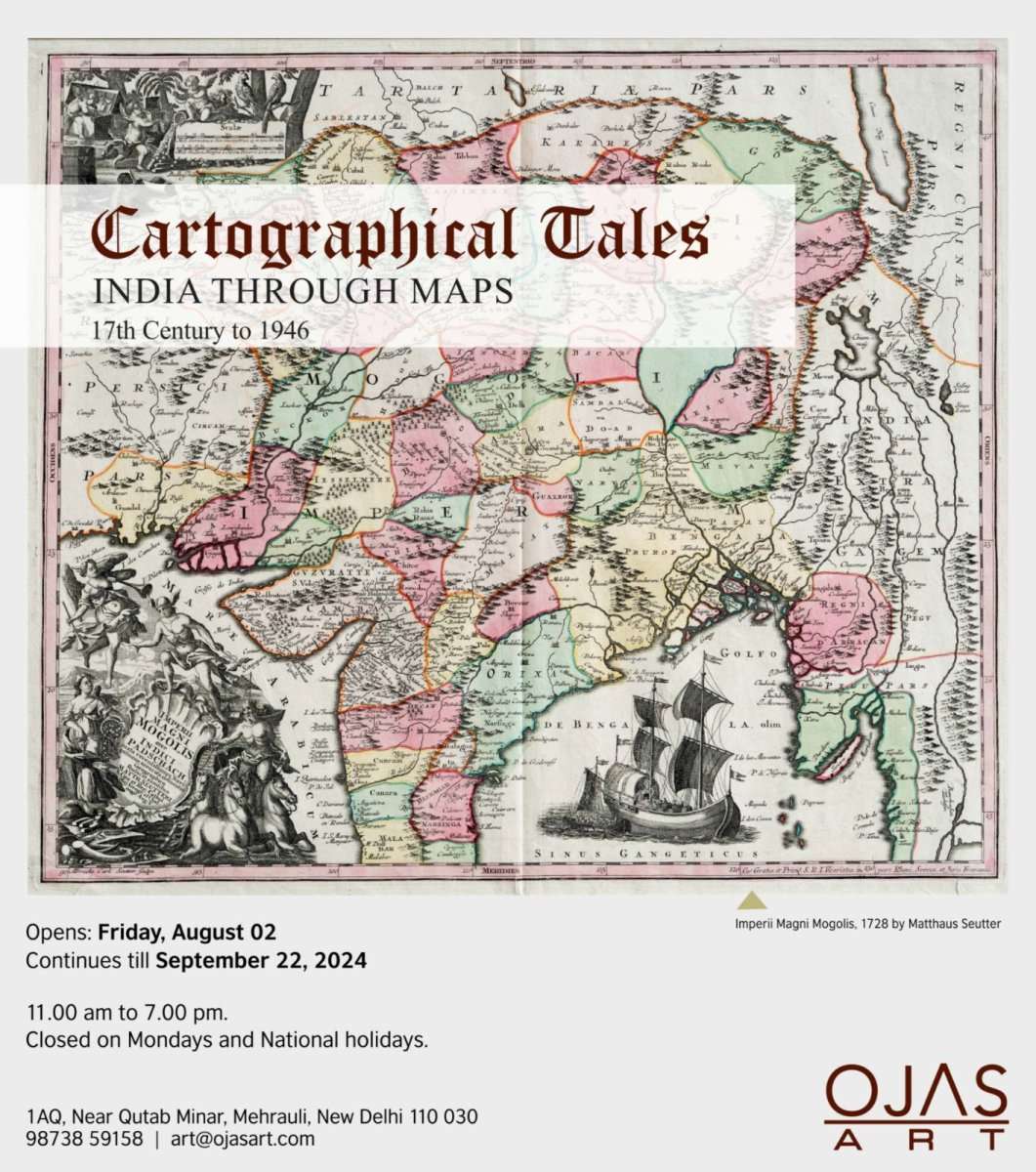
What: Anubhav Nath, Curatorial Director of Ojas Art, presents “Cartographical Tales: India through Maps” – an exhibition of unseen historical maps from the 17th century to 1946.
Where: Ojas Art, 1AQ, Near Qutub Minar, Mehrauli, New Delhi
When: August 02, 2024 – September 22, 2024
Time: 11 am to 7 pm every day (closed on Mondays and National holidays)